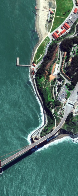
Aerial Photography and Satellite Imagery
Aerial Photography
High Resolution Color Aerial Photography- Aerial photographs for the continental United States (typically urban areas) that range from 2003-present day. These photographs are usually one foot to 6 inch resolution (one pixel on the image represents one foot or 6 inches on the ground).
Natural Color Aerial Photography- Aerial photographs for the continental United States that range from 2005-present day. Typically these photographs are within one to two meter resolution (one pixel on the image represents one or two meters on the ground).
Historic Aerial Photography- Digital Data Services, Inc. offers millions of high-resolution, historic aerial photographs for the entire United States dating back to the late 1930’s.
Satellite Imagery
WorldView-1- Launched on September 18, 2007 from Vandenberg Air Force Base,the satellite collects imagery with a panchromatic only (black and white) camera at 50 cm maximum resolution. It was the most powerful commercial satellite when launched.
WorldView-2- Launched on October 8, 2009, the satellite collects imagery with a panchromatic sensor at 50 cm maximum resolution and a multispectral sensor of 2m.
WorldView-3- The WorldView-3 satellite successfully launched on August 13, 2014. WorldView-3 provides 31 cm panchromatic resolution, 1.24 m multispectral resolution, 3.7 m short wave infrared resolution and 30 m CAVIS resolution. WorldView-3 is the world’s first super-spectral, high-resolution commercial satellite; SWIR bands penetrate haze, fog, smog, dust and smoke and the spectral diversity enables new imagery applications. With an average revisit time of <1 day, WV3 is capable of collecting up to 680,000 km2 per day.
Quickbird- Launched on October 18, 2001, the satellite collects imagery with a panchromatic camera at 60 cm resolution and a multispectral camera with a 2.4 m resolution.
GeoEye-1- The GeoEye-1 satellite is equipped with the most advanced technology ever used in a commercial remote sensing system. The satellite collects images at 0.41-meter panchromatic (black & white) and 1.65-meter multispectral resolution. Imagery from both sensors on the IKONOS satellite can be merged to create 50 centimeter color imagery (pan-sharpened).
IKONOS Satellite- GeoEye first made history with the IKONOS satellite launch almost ten years ago. Imagery from both sensors on the IKONOS satellite can be merged to create 1-meter color imagery (pan-sharpened).


